High Precision Fiber Optic Gyro INS IF4030-B – 0.15°~0.5° secφ North Seeking

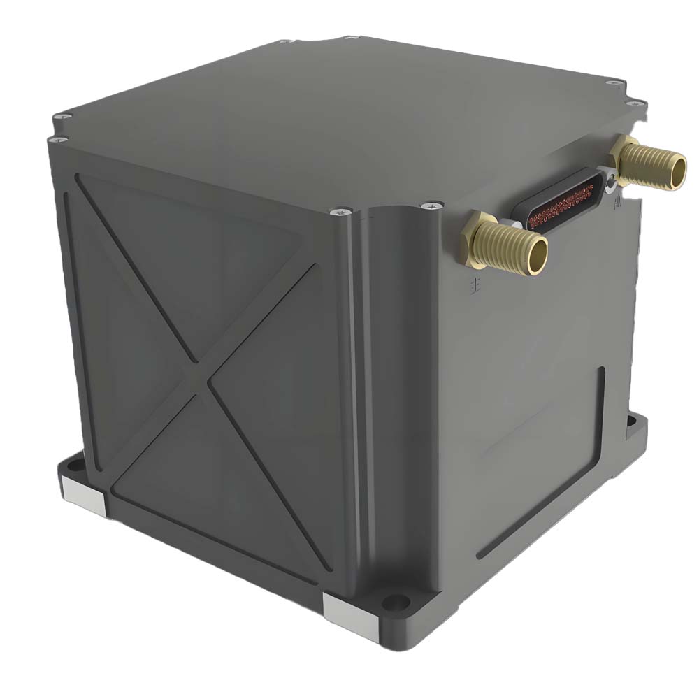
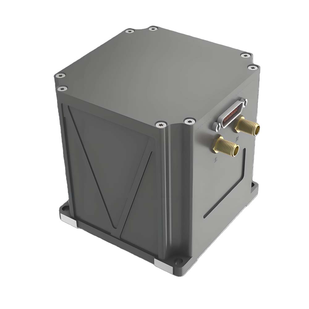
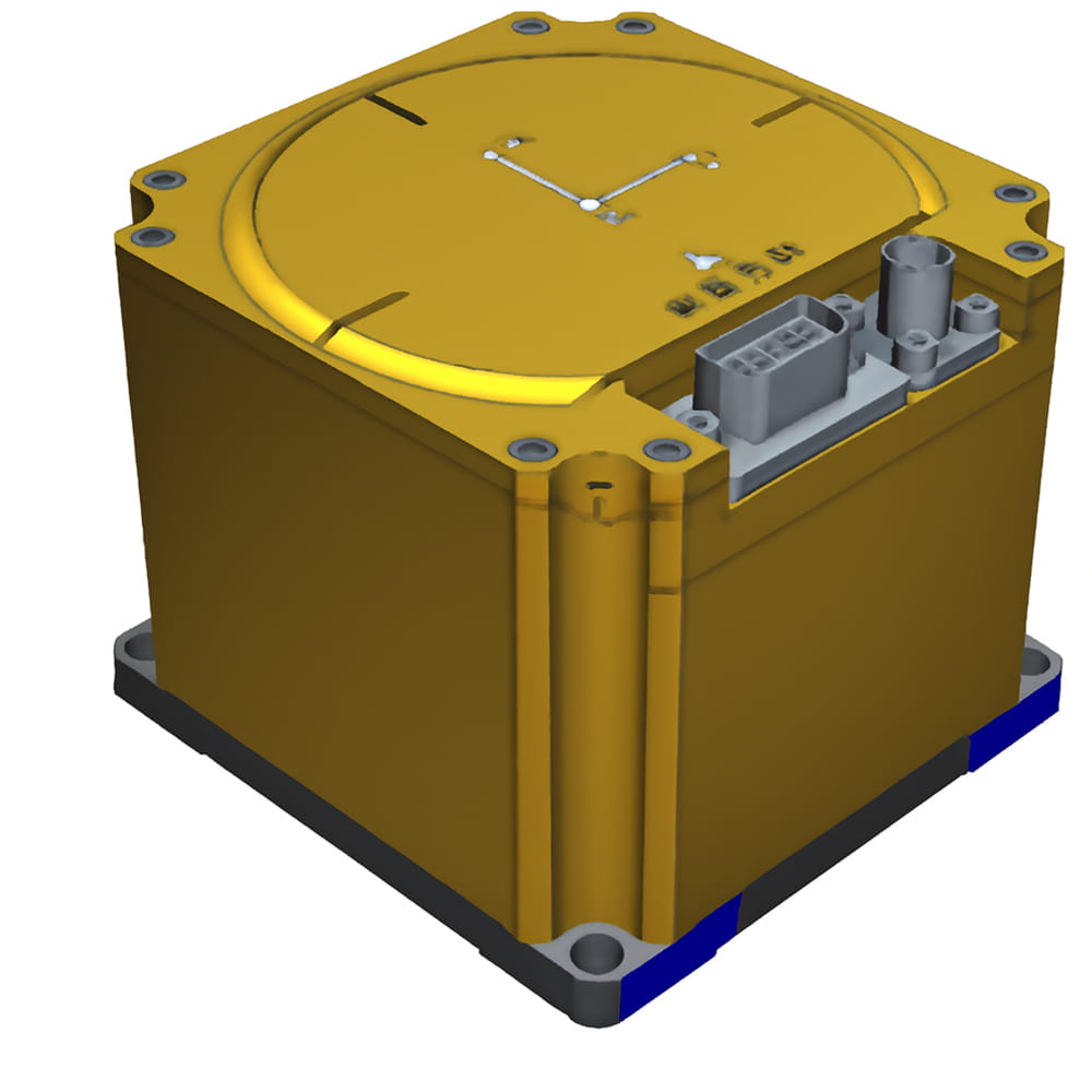
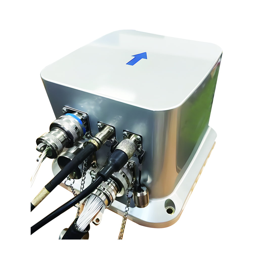
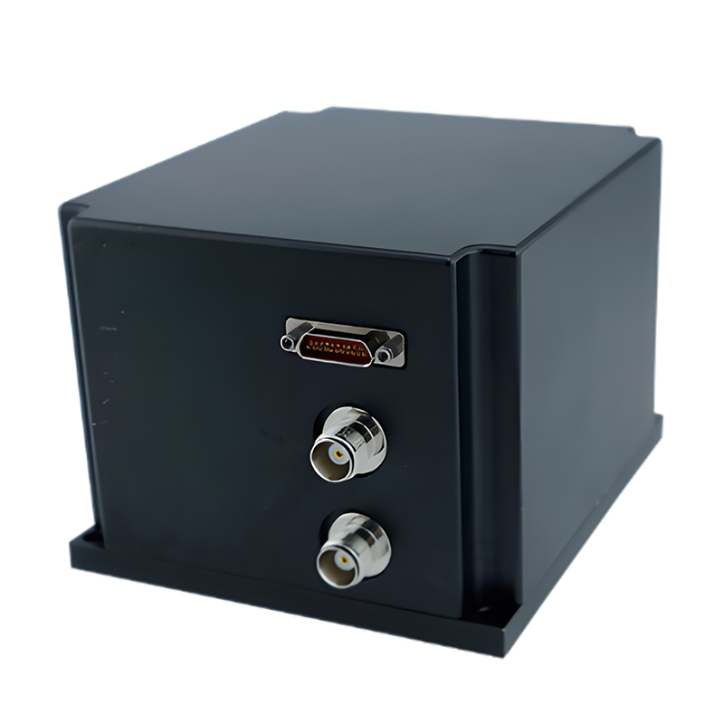
The IF4030 fiber optic inertial navigation system primarily consists of a miniaturized fiber optic gyroscope, quartz flexible accelerometer, power supply module, acquisition and computation module, and satellite navigation module. It is characterized by its compact size, lightweight, and high precision, making it suitable for various applications such as small and medium-sized drones, electro-optical pods, and underwater robots. The main features are as follows:

→  It has three accuracy levels: low, medium, and high, with self-north-finding accuracies of 0.5°, 0.25°, and 0.15°, respectively

→  It features multiple working modes, including pure inertial, inertial/satellite combination, inertial/DVL combination, inertial/odometer combination, inertial/vision combination, and marine compass

→  It possesses functions such as self-north-finding, transfer alignment, satellite-assisted moving-base alignment, high-precision post-processing, and heave measurement

→  Built-in multiple communication protocols, with configurable serial port baud rate and output protocol

→  Operating temperature: -45℃~+70℃

→  It features multiple interfaces such as RS422, RS232, Ethernet, and PPS input/output

→  Power supply: 12V~36V, power consumption <12W

→  Weight: 0.9kg

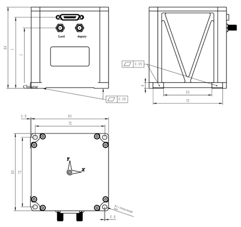
→  Size: 80mm×80mm×84mm


  • 零件编号 :

    IF4030-B
  • 订单(最小起订量) :

    1
  • leading time :

    30
  • 产品描述

Product Series and Parameters

    IF4030-B
Heading alignment accuracy (1σ) 0.05° (after maneuvering of the static dual-antenna (2m baseline) or single-antenna carrier)
Self North-seeking)
Attitude alignment accuracy 0.01° (1σ, Self North-seeking)), 0.008° (1σ, moving base)
Heading holding accuracy   0.15°/h (pure inertia)
0.05°/h (combined)
Pose holding accuracy (RMS) 0.02° (pure inertia)
0.008° (satellite combination)
Speed accuracy (RMS) 0.02m/s (RMS, integrated navigation, carrier velocity less than 500m/s)
3m/s (pure inertia)
Position accuracy (CEP) Horizontal <1.5m, elevation <3m (RMS, integrated navigation, satellite single-point positioning, signal good)
Horizontal <1cm+1ppm, vertical <2cm+1ppm (RMS, with good satellite carrier phase differential link)
4nmile/h (pure inertia)
Alignment time    4.5 minutes (self-north finding), 1 minute (dual-antenna assisted orientation), 15 minutes (moving base)
Gyroscope
performance
Range 500°/s
Zero-bias stability 0.1°/h (10s, smooth)
resolution 0.01°/h
bandwidth 400Hz
Accelerometer
performance
Range 30g
Zero-bias stability 50ug
Operating Temperature -45℃~70℃
Electromagnetic Compatibility Meet the relevant requirements of GJB151B for air force aircraft
Interface The power supply and communication socket model is J30J-25ZK, featuring interfaces such as RS422, RS232, Ethernet, and PPS input/output, with the option to customize a CAN interface
The antenna socket is SMA×2
Data update rate Navigation data: up to 200Hz, IMU data: up to 1kHz
Power supply Rated 28V DC, adaptable to 12V~36V
Power consumption <12W
Overall dimensions 80mm×80mm×84mm (excluding socket and backrest)
Weight 0.9kg

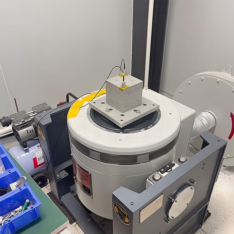
Production process


Product dimension

FOG INS


Application Scenarios

FOG INS application
The FOG-based INS (Inertial Navigation System) is suitable for high-accuracy navigation and guidance scenarios such as UAV/VTOL and aircraft navigation, vehicle/ship attitude & heading reference and GNSS/INS integrated navigation, antenna/radar/electro-optical stabilization platforms, and survey-grade mobile mapping & georeferencing—delivering ultra-low drift, excellent bias stability, and strong vibration/EMI robustness for long-duration and demanding environments.
Contact Us
MEMS accelerometer for UAV
UAV
MEMS accelerometer for robots
Robots
MEMS accelerometers are used in autonomous driving
Autonomous Driving

FAQ

1. What are the primary application scenarios for the IF4030 Inertial Navigation System?
The IF4030 is a high-precision inertial navigation system based on fiber-optic gyroscopes. Characterized by its compact size, lightweight design, and high accuracy, it is ideally suited for high-end unmanned platforms—such as small to medium-sized UAVs, electro-optical pods, and underwater robots—and is particularly well-suited for applications with stringent requirements for navigation precision.
 
2. What accuracy grades are available for the IF4030?
The IF4030 is available in three accuracy grades: A, B, and C. All grades share identical physical dimensions and interface configurations, with the following respective north-seeking accuracies:
Grade A: 0.5° × secφ
Grade B: 0.25° × secφ
Grade C: 0.15° × secφ
 
3. What is the product's heading alignment accuracy?
Static dual-antenna alignment (2m baseline) or single-antenna kinematic alignment: 0.05°
Self-north-seeking accuracy (Grades A/B/C): 0.5° – 0.15° × secφ5° for pitch and roll during initial alignment.
留言
如果您对我们的产品感兴趣并想了解更多详情,请在此留言,我们会尽快回复您。

相关产品

高精度光纤陀螺仪惯性导航系统 IF4030S – 0.15°~0.5° 秒φ 寻北

IF4030S光纤惯性导航系统主要由微型光纤陀螺仪、石英柔性加速度计、电源模块、采集计算模块和卫星导航模块组成。它具有体积小、重量轻、精度高等特点,适用于中小型无人机、光电吊舱、水下机器人等多种应用。其主要特点如下:→ 它有三个精度等级:低、中、高,对应的自北定位精度分别为 0.5°、0.25° 和 0.15°。→ 它具有多种工作模式,包括纯惯性模式、惯性/卫星组合模式、惯性/DVL组合模式、惯性/里程计组合模式、惯性/视觉组合模式以及航海罗盘模式。→ 它具备自寻北、传递对准、卫星辅助移动基座对准、高精度后处理和垂向测量等功能。→ 内置多种通信协议,串口波特率和输出协议均可配置→ 工作温度:-45℃~+70℃→ 它具有多种接口,例如 RS422、RS232、以太网和 PPS 输入/输出。→ 电源:12V~36V,功耗

查看更多
高精度光纤陀螺仪惯性导航系统 IF4030 – 0.15°~0.5° 秒φ 寻北

 IF4030光纤惯性导航系统主要由微型光纤陀螺仪、石英柔性加速度计、电源模块、采集计算模块和卫星导航模块组成。它具有体积小、重量轻、精度高等特点,适用于中小型无人机、光电吊舱、水下机器人等多种应用。其主要特点如下:→ 它有三个精度等级:低、中、高,对应的自北定位精度分别为 0.5°、0.25° 和 0.15°。→ 它具有多种工作模式,包括纯惯性模式、惯性/卫星组合模式、惯性/DVL组合模式、惯性/里程计组合模式、惯性/视觉组合模式以及航海罗盘模式。→ 它具备自寻北、转移对准、卫星辅助移动基准对准、高精度后处理和垂向测量等功能。→ 内置多种通信协议,串口波特率和输出协议均可配置→ 工作温度:-45℃~+70℃→ 它具有多种接口,例如 RS422、RS232、以太网和 PPS 输入/输出。→ 电源:12V~36V,功耗

查看更多
适用于无人机、船舶和机载应用的高性能光纤陀螺仪惯性导航系统,精准、可靠、稳健

本文是关于 IF4010 相关 FOG-40 型惯性测量单元的具体技术要求,该型惯性测量单元可广泛应用于车载、舰载、机载等领域。

查看更多
高精度光纤惯性导航系统双天线GNSS+INS RTK,适用于无人机、船舶和车辆

本产品内置三轴集成高精度光纤陀螺仪、三轴高精度石英柔性加速度计和移动测绘级多模多频GNSS接收机,支持自主北斗功能。通过先进的智能组合导航算法和卡尔曼滤波,针对GNSS遮挡和多径干扰进行了优化,可实现移动载体的高精度航向、姿态、速度和位置测量。该惯性导航系统还具有 GNSS/里程计/DVL/气压高度计等多种传感器接口,能够很好地满足城市峡谷等复杂环境下长期、高精度、高可靠性的导航应用要求,并可用于各种无人系统的导航和控制。产品特性包括:快速准确地确定初始航向和姿态,支持实时航向和姿态输出,内置GPS和北斗双模接收机,支持动态快速对准,INS/GNSS组合集成设计,支持IE后处理,增强型卡尔曼滤波算法,以及抗电磁干扰和抗振动能力。可应用于车载、机载、船舶导航、稳定性控制等领域。

查看更多
高精度光纤惯性导航系统,雾中精度0.001°/H,姿态精度0.002°,GNSS+INS RTK

该产品配备高精度闭环光纤陀螺仪,满温为0.0。01°/h 和 a 1这款0μg高精度石英加速度计采用多传感器数据融合技术,将惯性测量与GNSS相结合,实现长期高精度综合导航。产品还具备后处理功能,可通过后处理软件提升产品的航向、姿态和位置精度。

查看更多
无卫星Ins3700自检测技术无人船和无人机

IF3700采用高精度闭环 光纤陀螺仪 完全温度为 0.01°/h 和 20 μg型高精度石英加速度计可实现高精度纯惯性姿态测量。它具有自主罗盘功能,无需外部辅助即可长时间保持姿态和航向精度。可作为大型无人机、无人船、无人潜艇等的主要导航设备,广泛应用于航空、航天、导航等相关领域。

查看更多
高精度光纤惯性导航系统双GNSS+INS RTK模块

IF3500是自主研发的 光纤惯性导航系统 体积小、精度高,可实现0.1米精度的自主寻北。°该系统由一个零偏稳定性为 0.015 的光纤陀螺仪组成。°本产品配备高精度石英晶体加速度计和支持北斗功能的全系统多频卫星模块,可独立搜索北方,并支持单天线和双天线组合。此外,还搭载了优秀的导航融合算法,针对卫星遮挡、多径干扰等情况进行了优化。

查看更多
高精度GNSS识别系统自动驾驶与无人机

IF3000 由一个三轴集成驱动器组成。 光纤陀螺仪本产品包含石英晶体加速度计和支持北斗功能的全系统多频卫星模块。它配备了优秀的导航融合算法,即使在卫星失锁的情况下也能持续输出稳定可靠的导航信息。经过温度补偿和校准后,系统在整个温度范围内都能保证精度。本产品接口丰富,可连接里程计、数字速度计等传感器,具有良好的可扩展性,并可定制多种声明协议。

查看更多

留言

留言
如果您对我们的产品感兴趣并想了解更多详情,请在此留言,我们会尽快回复您。

产品

whatsApp

接触

购物车
item.name
[[ item.product_name ]]
[[ line.text ]]
[[ item.delivery_text ]]
* [[ item.qty ]]
Your Cart Is Empty!