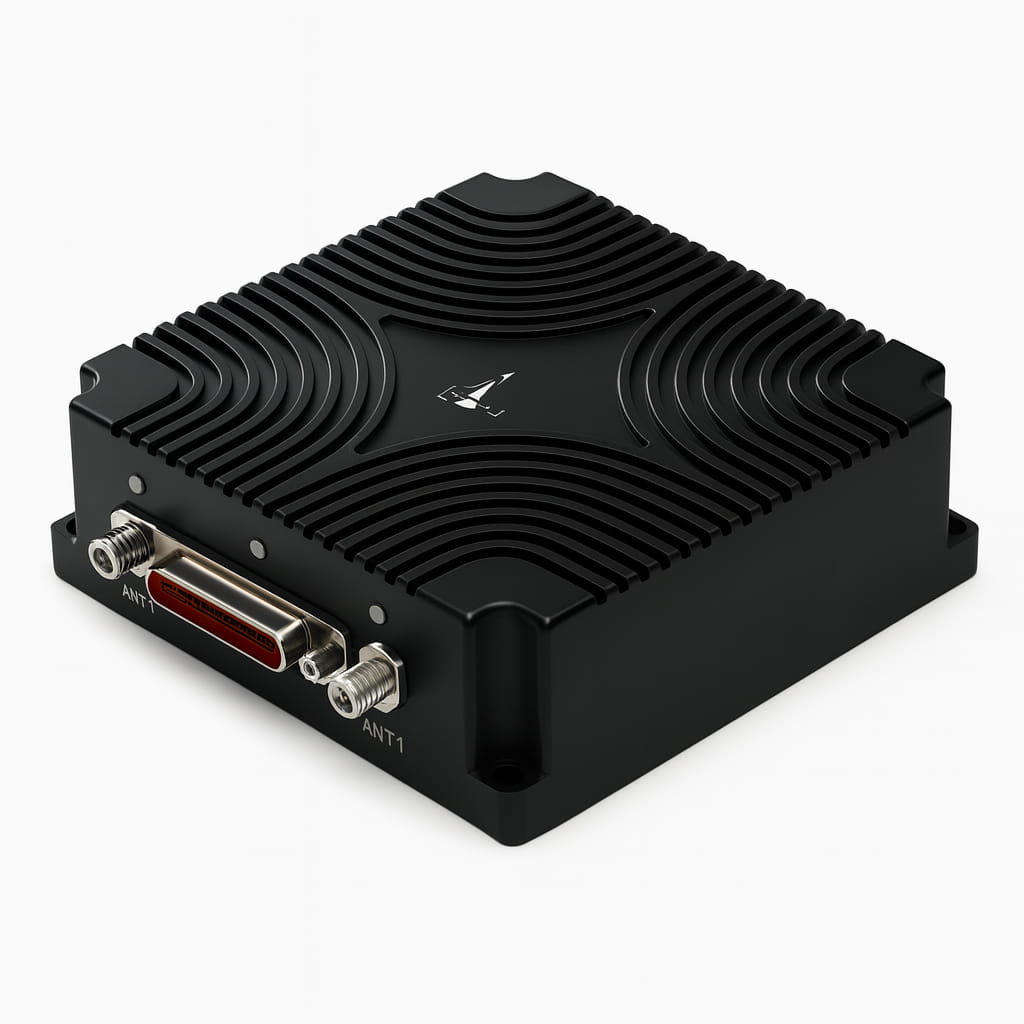
I6700-B MEMS High Precision Integrated INS/GNSS Navigation System RTK Dual Antenna 200Hz Output 9-36V ≤4W

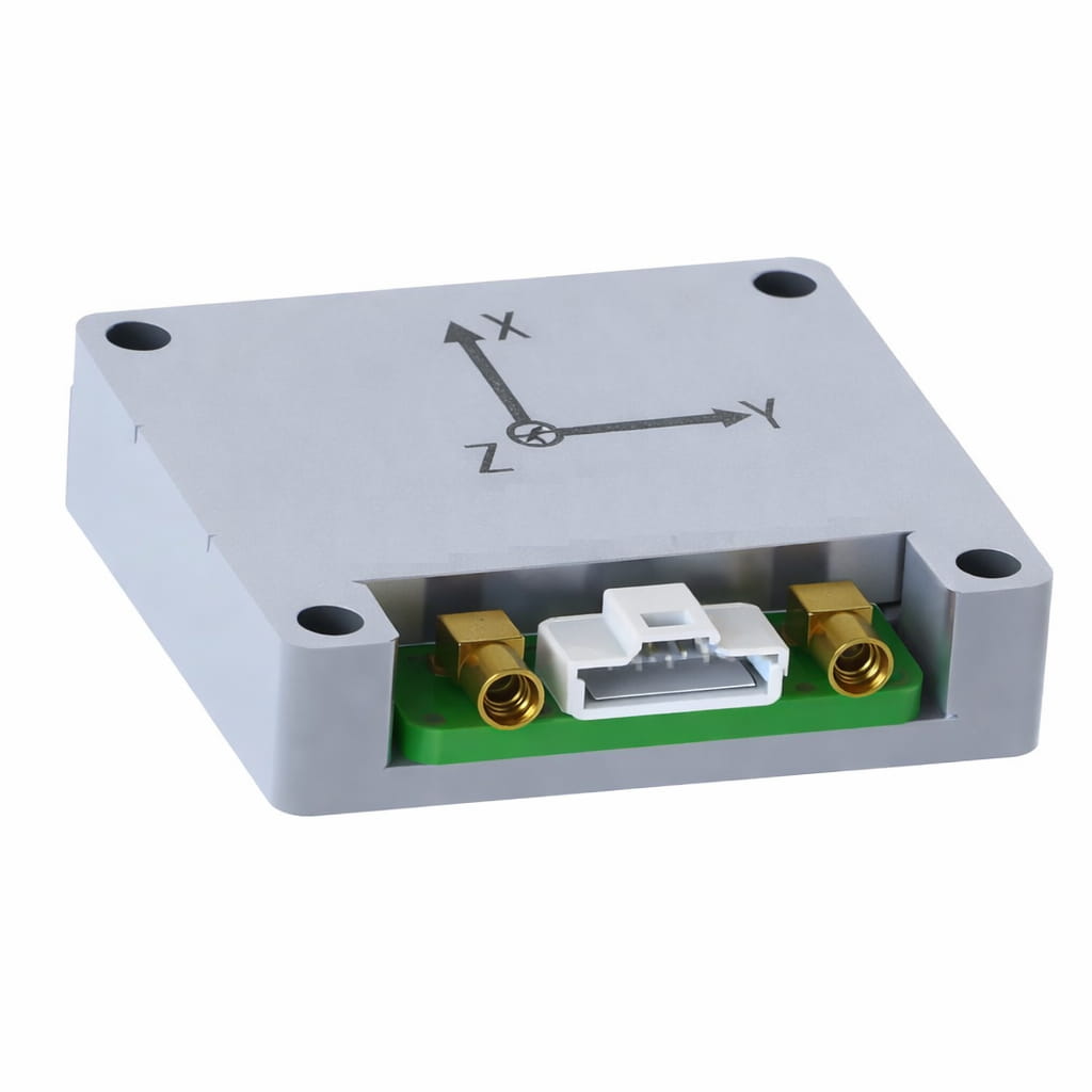
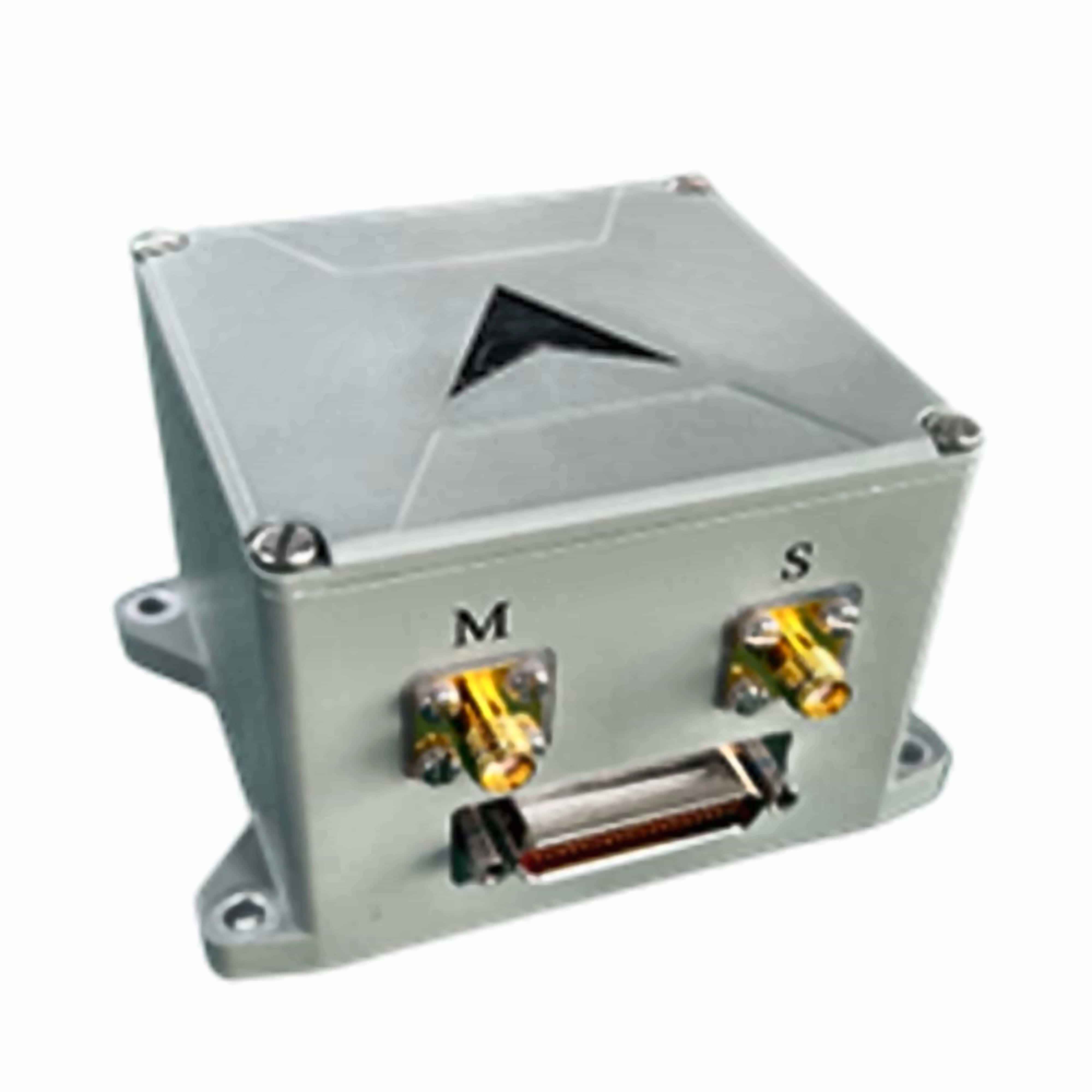
The I6700 series MEMS integrated navigation system is a high-precision, high-reliability, and cost-effective MEMS inertial integrated navigation system, which can be widely used in navigation, control, and measurement fields represented by vehicles, ships, and drones.

The I6700 series integrated navigation system integrates high-performance MEMS gyroscopes, MEMS accelerometers, and GNSS satellite receiver chips. By sensing the Earth's rotation angular rate and acceleration, it achieves true heading of the current carrier's motion through static self-alignment, and integrates with the three-dimensional velocity, position, and heading obtained from the satellite GNSS receiver for integrated navigation. The integrated navigation system performs temperature drift of zero bias compensation and full-temperature scale compensation on the internal IMU module to ensure product reliability.

The product offers various configuration modes to accommodate different carriers, such as airborne, vehicular, and shipborne. Appropriate scenario modes help ensure long-term measurement accuracy of the carrier's attitude.

  • 零件编号 :

    I6700-B
  • 订单(最小起订量) :

    1
  • leading time :

    25
  • 产品描述

Product Series and Parameters

Parameter Technical Indicators
  I6700-B
Gyroscope
Range(°/s) ±400
Full-temperature zero bias(°/h,3σ) ≤2
Zero bias stability(°/h,10s ) ≤0.5
Zero bias instability(°/h,allan,typ) ≤0.05
Zero bias repeatability(°/h) ≤0.3
Angle random walk(°/√h) ≤0.02
Scale factor nonlinearity(ppm) ≤100
Axis cross-coupling(rad) ≤0.001
Bandwidth(Hz) ≥200
Accelerometer
Range(g) ±30
Full-temperature zero bias(mg,3σ) ≤2
Zero bias stability(μg,10s) ≤50
Zero bias instability(μg,allan,typ) ≤30
Zero bias repeatability(ug) ≤50
Velocity Random Walk(m/s/√h) ≤0.03
Scale factor nonlinearity(ppm,±1g) ≤100
Axis cross-coupling(rad) ≤0.001
Bandwidth(Hz) ≥200Hz
Navigation Accuracy
North seeking accuracy (°,1σ) ≤3
Pure inertial accuracy after loss of lock(1σ,60s,Ignoring initial error) ≤5m/60s
Heave measurement accuracy ≤5cm
Combined Horizontal position (m,1σ) ≤2(single point)
  ≤0.02+1ppm(RTK)
Combined Skyward position (m,1σ) ≤3(single point),
  ≤0.03+1ppm(RTK)
Combined Horizontal velocity (m/s,1σ) ≤0.05
Combined Skyward velocity (m/s,1σ) ≤0.1
Combined Heading(°,1σ,real-time) ≤0.1(2m baseline dual-antenna)
≤0.15(single point, dynamic)
≤0.05(RTK,dynamic)
≤0.03(post-processing)
Combined Horizontal attitude (°,1σ,real-time) ≤0.015(single point, dynamic)
≤0.01(RTK,dynamic)
≤0.007(post-processing)
Physical Characteristics
Power supply(V) 9~36
steady-state power(W) ≤4
Startup time(s) ≤2
Data Rate(Hz,max) 200
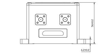
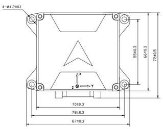
Size(mm×mm×mm) 87×72×56
Weight(g) 370±20
Operating Environment  
Operating temperature(℃) -40~+80
Storage temperature(℃) -55~+85
Vibration(g,RMS) 20~2000HZ,6.06
Shock(g) 500g/1ms

Production process


Product dimension

Inertial Navigation SystemINS


Application Scenarios

MEMS INS application
The MEMS-based INS (Inertial Navigation System) is suitable for navigation and motion control scenarios such as UAV/UGV autonomous navigation, vehicle/ship attitude measurement and GNSS/INS integrated navigation, antenna/camera stabilization platforms, and mobile mapping & positioning—providing compact size, low power consumption, fast start-up, and stable attitude/heading outputs for dynamic environments.
Contact Us
MEMS accelerometer for UAV
UAV
MEMS accelerometer for robots
Robots
MEMS accelerometers are used in autonomous driving
Autonomous Driving

FAQ

Q1: What is the I6700?
A: The I6700 is a high-precision integrated MEMS inertial navigation system (INS/GNSS). It integrates a MEMS gyroscope, MEMS accelerometer, and GNSS receiver chip, and can output navigation information such as attitude, heading, velocity, and position. It is suitable for applications in vehicles, ships, and drones.
 
Q2: What are the different models of the I6700? What are the differences between them?
A: The I6700 series includes the I6700-A, I6700-B, and I6700-C. The main differences lie in the IMU specifications and navigation performance parameters (such as gyroscope range, bias, and ARW).
 
Q3:Does it support RTK and dual-antenna heading? What is the approximate heading accuracy?
A: It supports RTK differential correction and dual-antenna (2m baseline) heading; real-time integrated heading accuracy can reach ≤0.1° (2m baseline dual-antenna), and the heading accuracy is even higher under dynamic RTK conditions.
留言
如果您对我们的产品感兴趣并想了解更多详情,请在此留言,我们会尽快回复您。

相关产品

用于无人机定位和姿态测量的MEMS集成导航系统GNSS INS

I3200 微型集成导航系统是一款紧凑且经济高效的基于 MEMS 的集成导航系统,主要面向移动通信和无人机等领域的导航、控制和测量。该系统将 MEMS 传感器和全频卫星接收芯片高度集成于小型封装内,从而能够在紧凑的封装中实现定位和姿态测量。

查看更多
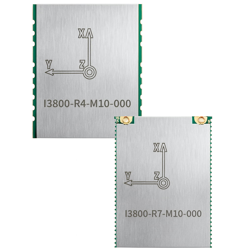
I3800 双天线 RTK GNSS/INS OEM 板 | 1cm RTK | 0.2° 航向角 | 100Hz | UART/CAN

硬件- 高性能阵列惯性测量单元- 出厂校准,温度补偿范围为-40至85℃,并已校准比例因子、十字轴和零点偏差陀螺仪零偏不稳定性高达 2.5°/h加速度计的零偏不稳定性高达 30 微克。- 多种接口,例如 UART (TTL)/CAN- 集成温度传感器- 小型表面贴装封装,易于集成- RoHS 和 CE 认证- 全星座、全频RTK-GNSS系统,双天线测向软件- 自适应扩展卡尔曼融合算法,能够以低延迟实现高达 100Hz 的输出。- 双天线定向,0.2°,1米基线- 它对线性加速度有极佳的抑制效果。- 时间精度为 20ns- 单点定位精度为1.5米- RTK定位精度为1厘米- 速度精度:0.03米/秒冷启动时间 < 30年代热启动时间 < 2秒- 支持多种协议,例如二进制、NMEA、J1939 等- 丰富的用户配置说明- 多功能图形用户界面,操作简便- 支持多种例程,例如 ROS 和 C 

查看更多
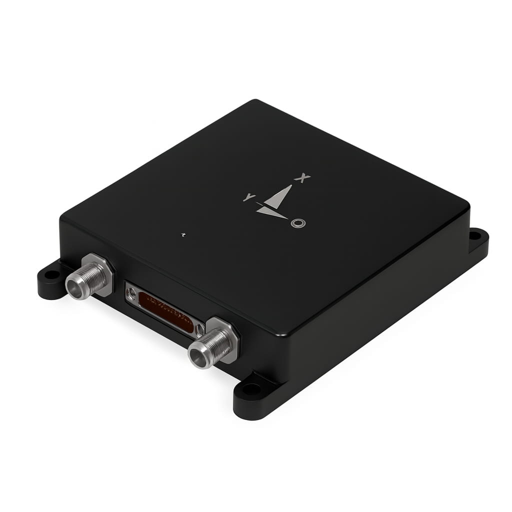
MEMS GNSS/INS 集成导航系统 | 双天线航向角 0.05° | RTK 精度 1cm | 200Hz | RS422/CAN

I5000 内置高精度 GNSS 模块和出厂校准的 IMU,能够持续高频地提供高精度的位置、速度和姿态信息。即使在城市峡谷、阴影区域和隧道等复杂环境下,I5000 也能凭借多源卡尔曼滤波等多种算法,保持可用性和自评估可靠性。 产品特性⚪ 支持北斗、GPS、GLONASS、伽利略和准天顶卫星系统全系统多频点,并支持北斗三号卫星系统⚪ IMU已在工厂完成校准⚪ 自适应静态/动态对齐⚪ 可配置的通用车辆运动信息(例如 ODM)接口⚪ 自适应补偿系统安装误差和 ODM 比例误差⚪ GNSS 信号中断时,水平定位精度可达 0.2%×D 以内①  应用⚪ 自动驾驶⚪ 平台稳定性和控制⚪ 自动化机械⚪ 机器人控制 

查看更多
双天线RTK GNSS/INS集成导航系统 | 1厘米RTK精度 | 0.1°航向角 | 200Hz | 以太网/CAN/RS232接口

I6000是林斯科技自主研发的模块级MEMS集成导航系统。它集成了MEMS惯性测量单元(IMU)和高精度双天线GNSS。利用多源卡尔曼滤波融合算法,即使在复杂环境下也能提供连续可靠的高精度定位导航信息。该产品广泛应用于卫星通信、无人机、测绘、智能驾驶等领域。  产品特性⚪ 支持北斗、GPS、GLONASS、伽利略和准天顶卫星系统全系统多频点,并支持北斗三号卫星系统⚪ IMU已在工厂完成校准⚪ 自适应静态/动态对齐⚪ 可配置的通用车辆运动信息(例如 ODM)接口⚪ 自适应补偿系统安装误差和 ODM 比例误差⚪ GNSS 信号中断时,水平定位精度可达 0.2%×D 以内①⚪ 最高可选配 32GB 内部存储空间 应用⚪ 自动驾驶⚪ 平台稳定性和控制⚪ 自动化机械⚪ 机器人控制 

查看更多
用于无人车辆和船舶的高精度MEMS集成导航系统GNSS/INS融合

I4500 集成导航系统内置高性能 MEMS 陀螺仪和加速度计,可接收外部 GNSS 数据,实现多传感器融合和集成导航算法,并在 GNSS 失效时具有短期惯性导航能力。该产品具有高可靠性和较强的环境适应性。通过匹配不同的软件,该产品可广泛应用于战术和工业无人机、无人车辆、无人舰艇、航空制导炸弹、智能弹药、火箭、移动通信、测绘、导引头和稳定平台等领域。该产品分为低配置版(I4500-A)和高配置版(I4500-B)。两款产品精度和价格不同,用户可根据具体使用条件方便选择。

查看更多
I6700 MEMS 高精度集成式 INS/GNSS 导航系统 RTK 双天线 200Hz 输出 9-36V ≤4W

I6700系列MEMS集成导航系统是一款高精度、高可靠性且经济高效的导航系统。 MEMS惯性集成导航系统可广泛应用于车辆、船舶和无人机所代表的导航、控制和测量领域。I6700系列集成导航系统集成了高性能MEMS陀螺仪、MEMS加速度计和GNSS卫星接收机芯片。通过感知地球自转角速率和加速度,该系统利用静态自对准技术获得当前载体运动的真实航向,并与从卫星GNSS接收机获取的三维速度、位置和航向信息进行集成导航。该集成导航系统对内部IMU模块进行零点偏差温度漂移补偿和全温标补偿,以确保产品可靠性。该产品提供多种配置模式,以适应不同的载体,例如空中、车辆和舰载。合适的场景模式有助于确保载体姿态的长期测量精度。

查看更多
用于农业无人机的高度集成小型保险丝

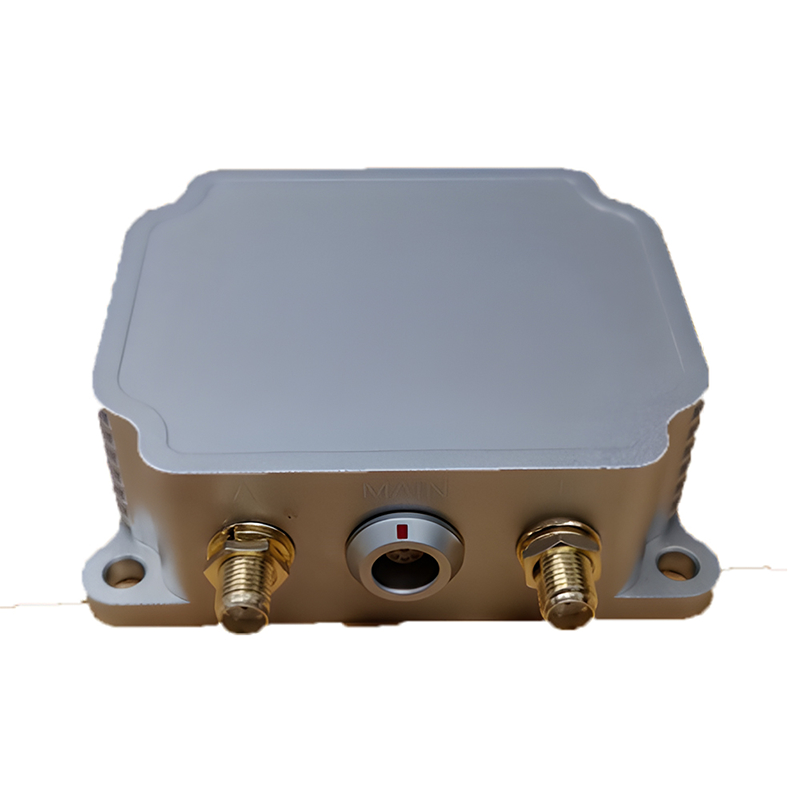
I3700 是一个 集成导航系统 (GNSS/INS)由高性能MEMS传感器、高精度GNSS系统和高性能微处理器组成。内置自主研发的高可靠性集成导航算法,可实时输出被测载体的速度、位置、姿态等信息。用户还可以外接RTCM差分校正数据,实现高精度RTK定位。IP68防水外壳设计,便于集成到用户系统中。产品型号信息如下:

查看更多
MEMS+GNSS单天线导航传感器,RS232/RS422输出,支持RTK/NTRIP

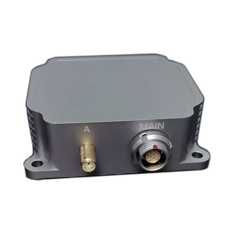
I3500 是 集成导航系统 (GNSS/INS)由高性能MEMS传感器、高精度GNSS系统和高性能微处理器组成。内置自主研发的高可靠性集成导航算法,可实时输出被测载体的速度、位置、姿态等信息。用户还可以外接RTCM差分校正数据,实现高精度RTK定位。IP68防水外壳设计,便于集成到用户系统中。产品型号信息如下:

查看更多

留言

留言
如果您对我们的产品感兴趣并想了解更多详情,请在此留言,我们会尽快回复您。

产品

whatsApp

接触

购物车
item.name
[[ item.product_name ]]
[[ line.text ]]
[[ item.delivery_text ]]
* [[ item.qty ]]
Your Cart Is Empty!